


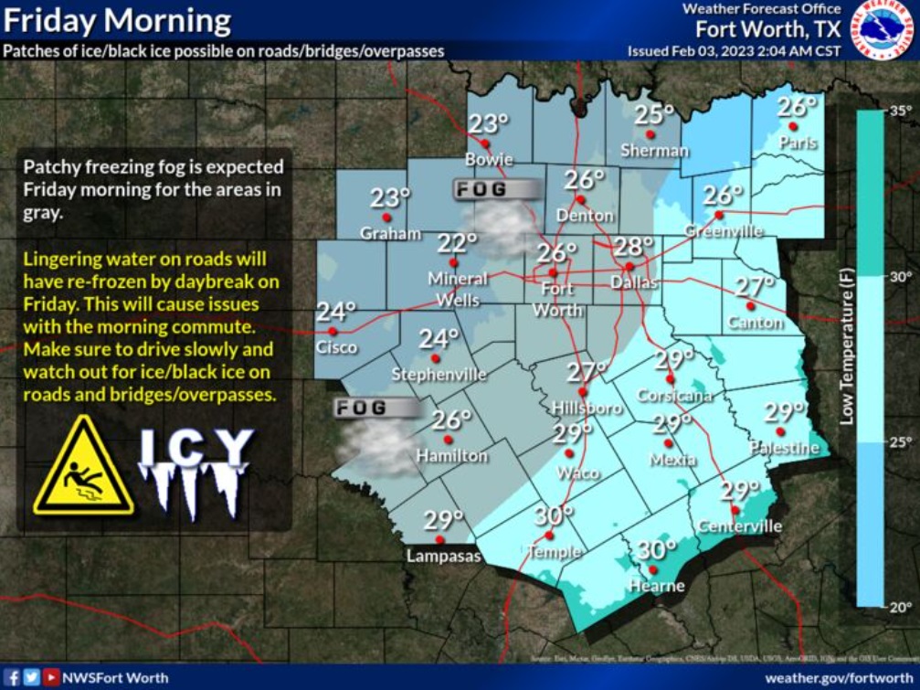
Remain vigilant for icy patches on roads, especially bridges, overpasses, and side streets. Sidewalks are also likely to remain icy through Friday morning. Patchy freezing fog is also expected to continue through early Friday morning, and will exacerbate impacts to travel during the morning commute.
Overnight
Patchy freezing fog. Partly cloudy, with a steady temperature around 31. North northwest wind around 5 mph.
Friday
Patchy freezing fog before 8am. Sunny, with a high near 45. North northwest wind 5 to 10 mph.
Friday Night
Patchy freezing fog after 5am. Increasing clouds, with a low around 29. Calm wind becoming south around 5 mph after midnight.
Saturday
Patchy fog between 9am and 10am. Areas of freezing fog before 9am. Otherwise, partly sunny, with a high near 57. South wind 5 to 15 mph, with gusts as high as 20 mph.
Saturday Night
Partly cloudy, with a low around 40. South wind 10 to 15 mph, with gusts as high as 20 mph.
Sunday
Sunny, with a high near 62. South southwest wind around 10 mph.
Sunday Night
Partly cloudy, with a low around 47. South wind 10 to 15 mph, with gusts as high as 20 mph.
Monday
Partly sunny, with a high near 70. South wind 15 to 20 mph, with gusts as high as 35 mph.
Monday Night
Mostly cloudy, with a low around 54. South wind 15 to 20 mph, with gusts as high as 30 mph.
Tuesday
A 40 percent chance of showers, mainly after noon. Cloudy, with a high near 63.