


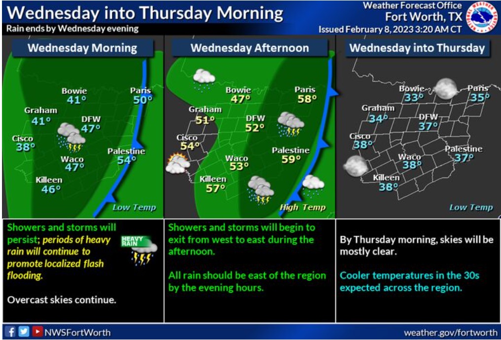
Periods of heavy rain will allow for a continued flash flood threat. Remember to never drive through flooded roads! Over the afternoon, the rain will exit the region from west to east, and end completely by the evening hours. Clouds will be slower to exit, and skies should be mostly clear by Thursday morning.
Overnight
Showers and possibly a thunderstorm. Patchy fog. Low around 48. North northwest wind 10 to 15 mph, with gusts as high as 20 mph. Chance of precipitation is 80%. New rainfall amounts between a quarter and half of an inch possible.
Wednesday
Showers and possibly a thunderstorm before 3pm, then a slight chance of showers. Patchy fog before 2pm. Steady temperature around 48. West wind 10 to 15 mph, with gusts as high as 25 mph. Chance of precipitation is 90%. New rainfall amounts between a quarter and half of an inch possible.
Wednesday Night
Patchy fog between midnight and 1am. Otherwise, mostly clear, with a low around 37. West wind 10 to 15 mph becoming southwest 5 to 10 mph after midnight. Winds could gust as high as 25 mph.
Thursday
Sunny, with a high near 62. South wind 5 to 10 mph becoming northwest in the afternoon.
Thursday Night
Mostly clear, with a low around 37. Northwest wind 10 to 15 mph, with gusts as high as 25 mph.
Friday
Mostly sunny, with a high near 50. North northwest wind around 20 mph, with gusts as high as 35 mph.
Friday Night
Mostly clear, with a low around 30. North northwest wind 5 to 15 mph, with gusts as high as 25 mph.
Saturday
Sunny, with a high near 56. Northwest wind 5 to 10 mph becoming south in the afternoon.
Saturday Night
Mostly clear, with a low around 35. South wind around 10 mph.
Sunday
Partly sunny, with a high near 58.