


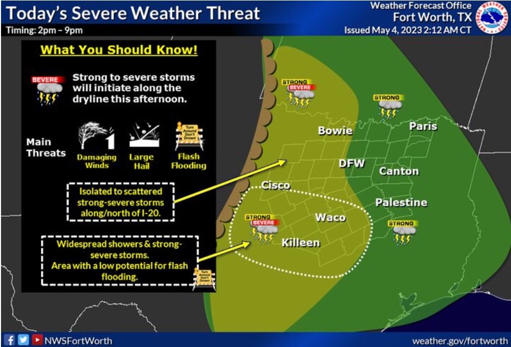
Storms will initiate along a north-south oriented dryline expected to be just west of our region. Across North Texas, isolated to scattered strong to severe storms may pose mainly a large hail and damaging winds threat. The greatest concentration of is expected to be across Central Texas.
Thursday
A 40 percent chance of showers and thunderstorms after 4pm. Increasing clouds, with a high near 84. South wind 5 to 15 mph, with gusts as high as 20 mph.
Thursday Night
A 30 percent chance of showers and thunderstorms, mainly before 7pm. Cloudy, then gradually becoming partly cloudy, with a low around 69. South wind around 15 mph, with gusts as high as 25 mph.
Friday
Mostly sunny, with a high near 93. South southwest wind around 15 mph, with gusts as high as 20 mph.
Friday Night
Partly cloudy, with a low around 70. South wind 10 to 15 mph, with gusts as high as 20 mph.
Saturday
A 20 percent chance of showers and thunderstorms after 1pm. Mostly sunny, with a high near 92. South wind 10 to 15 mph, with gusts as high as 20 mph.
Saturday Night
A 20 percent chance of showers and thunderstorms before 1am. Mostly cloudy, with a low around 69. South wind 10 to 15 mph, with gusts as high as 25 mph.
Sunday
A 30 percent chance of showers and thunderstorms after 1pm. Partly sunny, with a high near 89. South wind 10 to 15 mph, with gusts as high as 20 mph.