


DALLAS – (WBAP/KLIF) – A severe thunderstorm watch now in effect for the entire DFW listening area through 12 midnight.
Storms that could be severe are moving into North Texas and the Dallas Fort Worth Metroplex, expected to arrive with intensity beginning around the rush hour drive home. The area could see 50-60 mile per hour winds and the possiblity of golfball sized hail. A slight chance of tornado formation as well. From WBAP/KLIF Chief Meterologist Brad Barton:
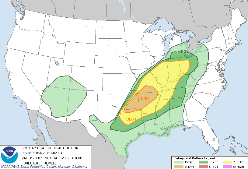
“The WBAP/KLIF Storm Prediction Center continues to put the heaviest storms near and north of the Texas/OK border, while DFW anchors the southwest corner of the “Slight Risk” area. We’re expecting storm development here in DFW after 5 or 6 P.M. Storm development will be slow until we break the “cap” or inversion of warm temps aloft, which is slowly underway.
We can expect slow but steady storm development in our local area from 6 P.M. through 10 P.M. Our main risks are high winds and hail, with tornado risk generally northeast of DFW.
Tornado watch including Wise County until 6P.M. We can expect storms to develop in the DFW metro after 5-6.P.M.
Stay tuned to News Talk 820 WBAP now on 93.3 as well as 570 AM News Talk KLIF for all leading weather details.
(Copyright, All Rights Reserved, WBAP/KLIF 2024)